DESIGN SHAPES HOW WE EXPERIENCE THE WORLD.


Home > Luxima Design Studio > Project
Transforming Toronto’s busiest North York transfer point into a safe, legible, and welcoming gateway, separating modes, improving last-mile access, and creating a vibrant civic forecourt.
Yonge & Finch Mobility-Hub Streetscape Upgrade
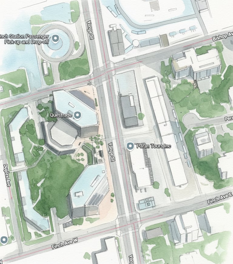
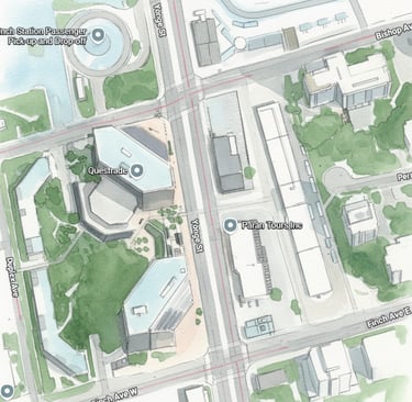
Location: Yonge Street at Finch Avenue (Finch Station TTC / GO / YRT Mobility Hub)
Current Issues
Gap in east–west connections. People exiting North York Centre or Sheppard–Yonge subway must detour long blocks; mid-block crossings are scarce and unsafe, especially at night.
Last-mile friction. The “ring roads” (Beecroft & Doris) function as fast bypasses; there are few protected routes for micromobility (bikes, scooters, delivery).
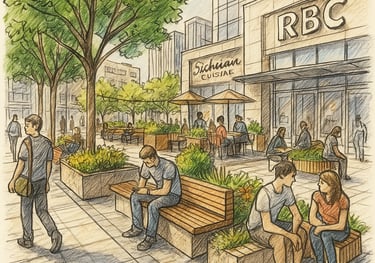
Under-performing edges. Building forecourts and setbacks along Beecroft/Doris are fragmented, windy, and unprogrammed poor places to linger or wait for rideshare.
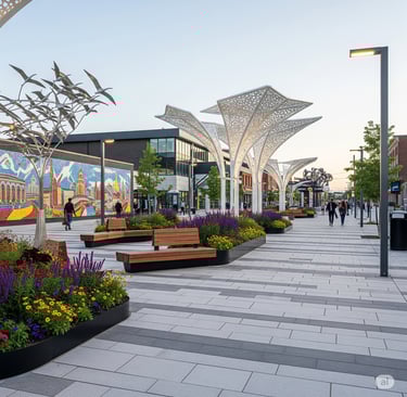
Event overflow & wayfinding. Big draws (Civic Centre, Douglas Snow, Empress Walk, Mitchell Field) create surges with unclear pedestrian paths and limited shaded seating.
Collision & near-miss pattern. Turning conflicts at Park Home/Empress and Sheppard approaches; long crossing distances and poor night visibility.
Why This Matters
The City has invested in density, transit, and cultural assets here, but the public-realm network between them is discontinuous.
A safe, legible west–east spine would reduce jaywalking, calm speeds on the ring roads, strengthen retail, and support recurring events.
Deliverable within ROW & setbacks using quick-build materials first, then permanent works.
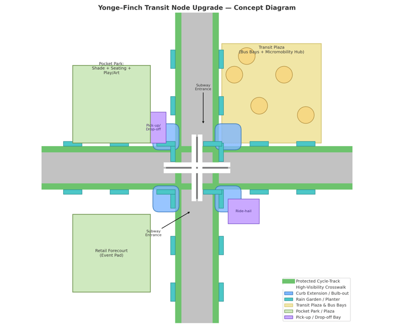
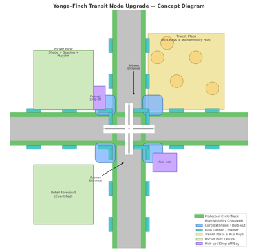
Proposed Solution
Create a “West–East Connector Spine” linking Beecroft → Yonge → Doris at three key bands:
Park Home / Empress, 2) North York Blvd, 3) Sheppard Ave.
Each band receives:
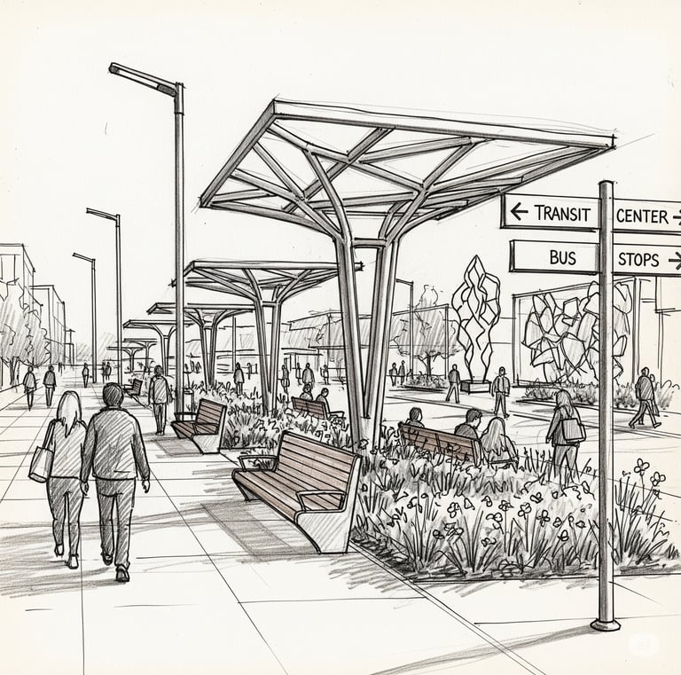
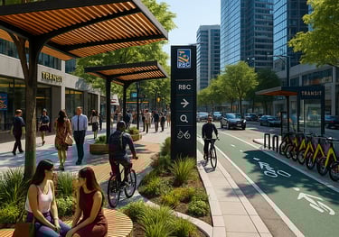
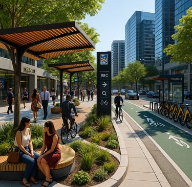
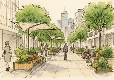
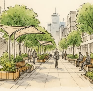
Protected Cross-Town Links. Curb-separated cycle tracks & widened sidewalks from Beecroft to Doris with priority mid-block crossings at Yonge.
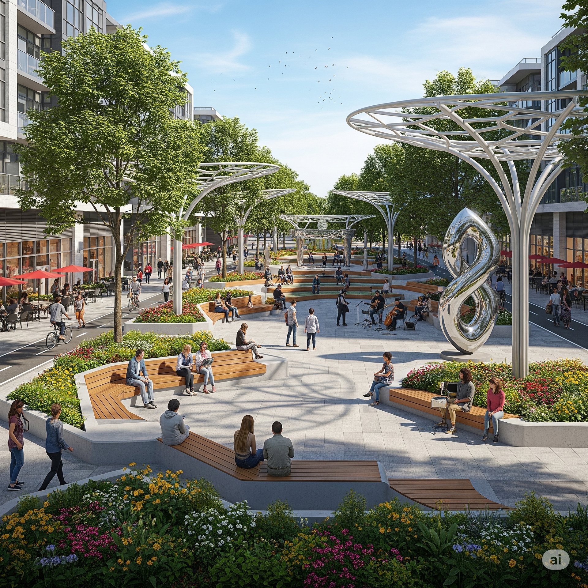
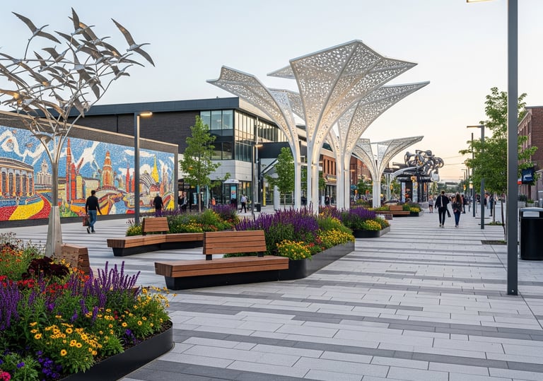
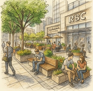
Pocket-Plazas @ Gateways. Programmable nodes (shade canopies, power, water, seating) at Beecroft & Doris corners to absorb crowds and host pop-ups.
Safer Intersections. Tightened curb radii, raised crosswalks, leading pedestrian intervals (LPI), scramble at the heaviest crossing, and continuous nighttime lighting.
Green/Blue Additions. Linear rain-gardens in the furnishing zone, wind-buffer planting, and permeable pavers to reduce splash and heat.
Wayfinding Layer. Ground inlays + vertical beacons to theatres, rink, library, subway, and civic buildings.
Design Features
Protected Micromobility Spine (both sides): 2.0–2.5 m bi-directional track + 2.5–3.0 m pedestrian clearway; 0.6–0.9 m buffer with planters/curbs.
Raised Mid-block Crossings at Yonge (one per band), daylighted by 5 m setback; tactile surfaces for accessibility.
Pocket-Plazas (350–600 m² each): modular benches, pergola shade, 20A power posts, water bib, event lighting; coordinated retail spill-out.
Green-Blue Furnishing Zone: alternating rain-gardens (1.2 m wide) and tree trenches; salt-tolerant species; subsurface soil cells.
Night Visibility Package: continuous pole lights (3000 K), warm under-bench LEDs, and crosswalk floodlighting tied to LPIs.
Deliveries & TNC Pick-up: signed curb bays off the cycle track (with steel islands) to eliminate conflicts.
Phasing & Delivery
Phase 1 (Quick-Build, 0–12 months): paint + post protected cycle lanes; temporary PUDO bays with geofencing; curb extensions using modular planters; upgraded crosswalk markings; pilot wayfinding.
Phase 2 (Capital, 12–36 months): full curb relocation and sidewalk widening; permanent PUDO lay-by; utility relocation; canopies, trees, bio-swales, granite paving, and smart lighting; mobility hub facilities.
Phase 3 (Programming, ongoing): monthly night market, cultural performances, and community activation managed with BIA & City.
Phasing & Delivery
25–40% reduction in turning-related conflicts at the three bands.
+15–25% increase in dwell time and evening footfall at gateway nodes.
Mode shift to walking/micromobility on ring roads; improved retail frontage performance.
Heat & stormwater relief via linear green-blue infrastructure.
Begin a Design Inquiry.
Transforming ideas into breathtaking architectural realities.
contact:
Start an Inquiry:
© 2024. Sama Karim Design Studios. All Rights Reserved.