DESIGN SHAPES HOW WE EXPERIENCE THE WORLD.


Home > Luxima Design Studio > Project
Re-imagining transit nodes, edges, and shared public spaces through human-centered urban design.
Urban Public Realm Study | Toronto Mobility & Civic Spaces
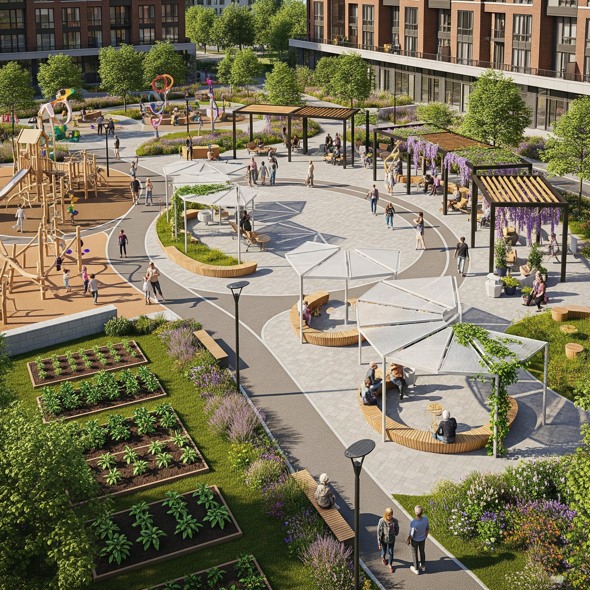
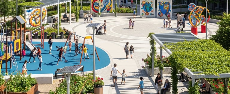
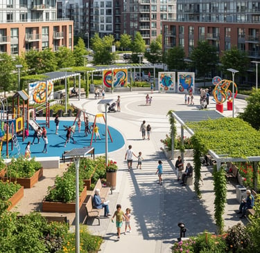
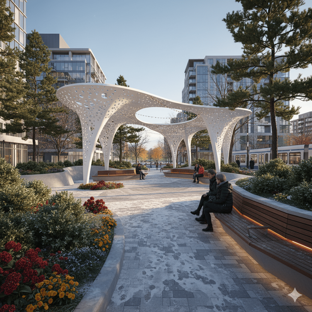
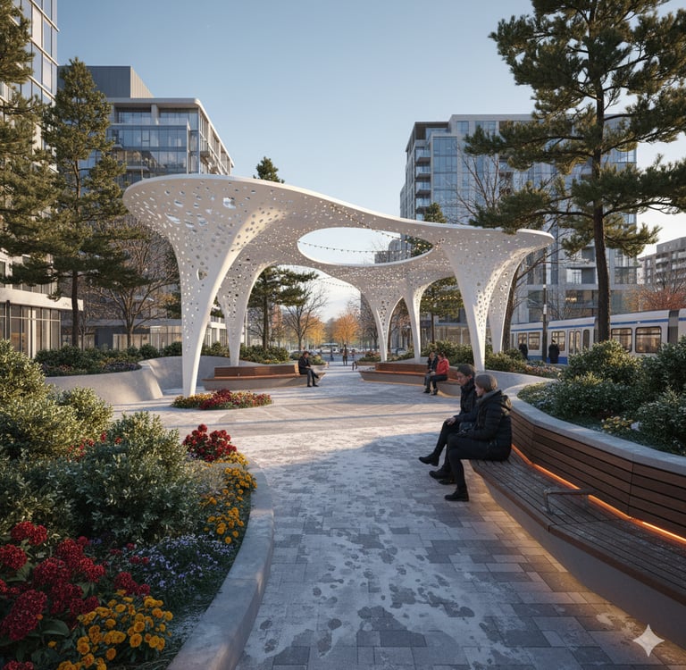
Antibes Community Node
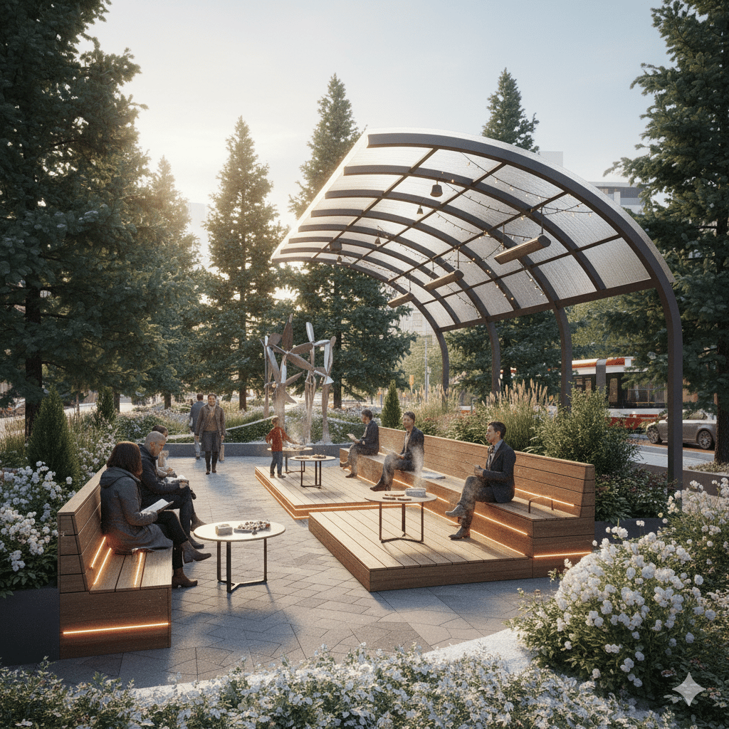
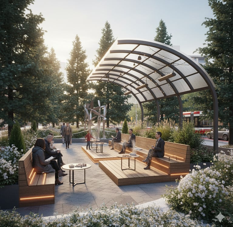
Esther Shiner Park Edge + Transit Access Zone
Location: Toronto
This study examines Toronto’s public realm conditions across key mobility corridors and community nodes.
The focus is on improving pedestrian comfort, social gathering, active frontages, and civic identity, particularly in high-density urban districts
Toronto’s urban landscape is defined by a layered interaction between streets, transit corridors, public plazas, mid-rise residential blocks, and cultural/community anchors. As the city continues to densify, the design of everyday public elements benches, lighting, shading systems, planting, circulation paths, and storefront activity—becomes critical in shaping how people experience and engage with their surroundings.
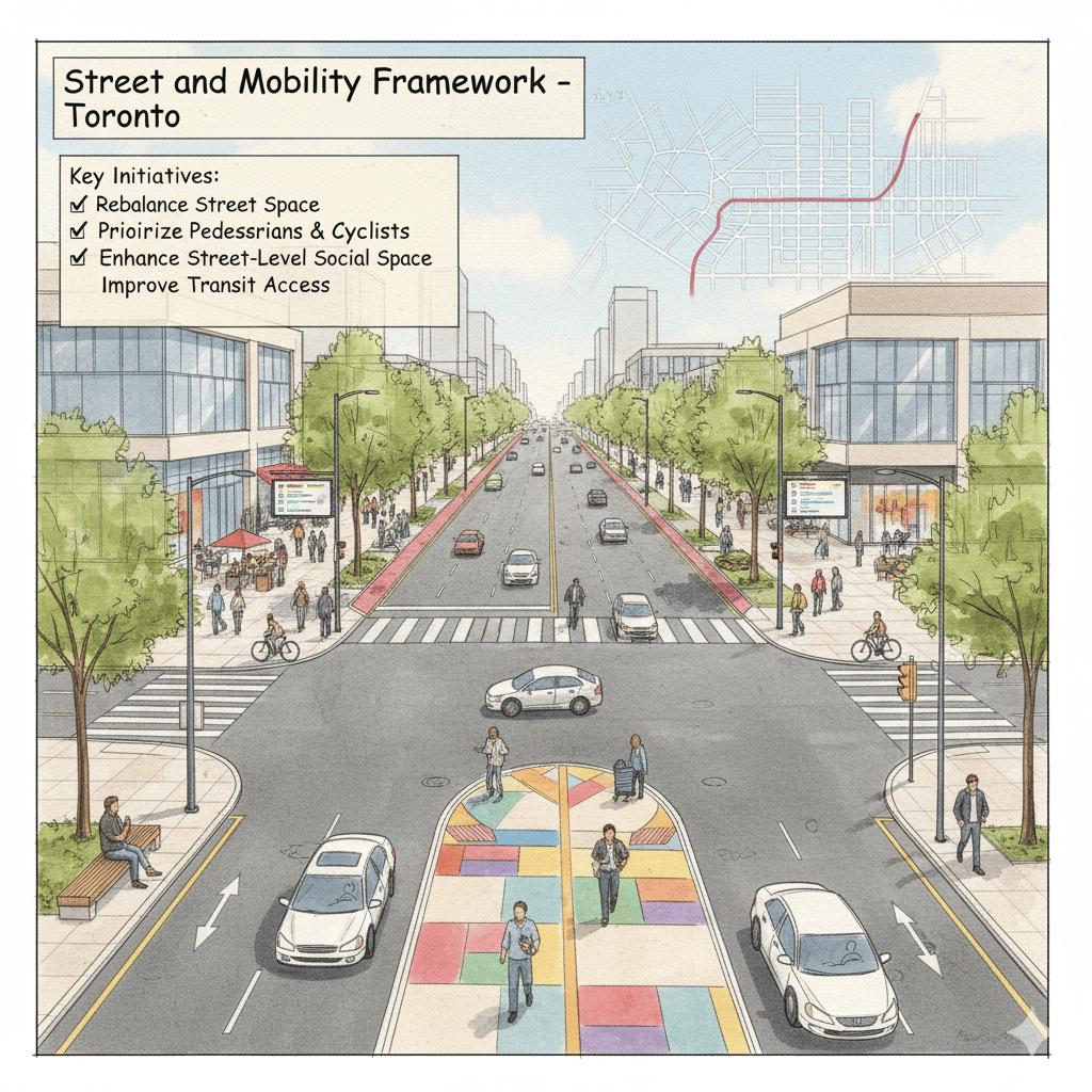
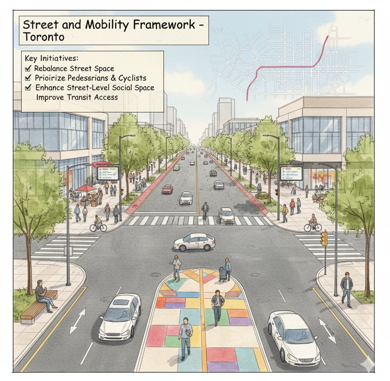
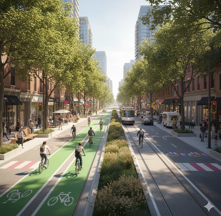
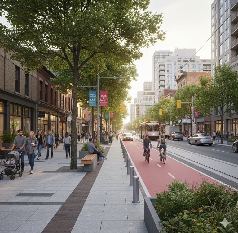
1. Street and Mobility Framework
Toronto operates on a grid system shaped by its major avenues (Yonge, Bloor, Bathurst, Finch, Eglinton, Lawrence) and collector streets feeding into transit nodes.
However, many of these corridors function as vehicular priority zones, resulting in:
Wide traffic lanes and narrow pedestrian realms
Limited sidewalk activation and insufficient street-level social space
Poor pedestrian crossing conditions
Design Opportunity:
Re-balancing street hierarchy toward multi-modal circulation: widening sidewalks, adding cycling lanes, furnished public edges, and tree-lined buffers.
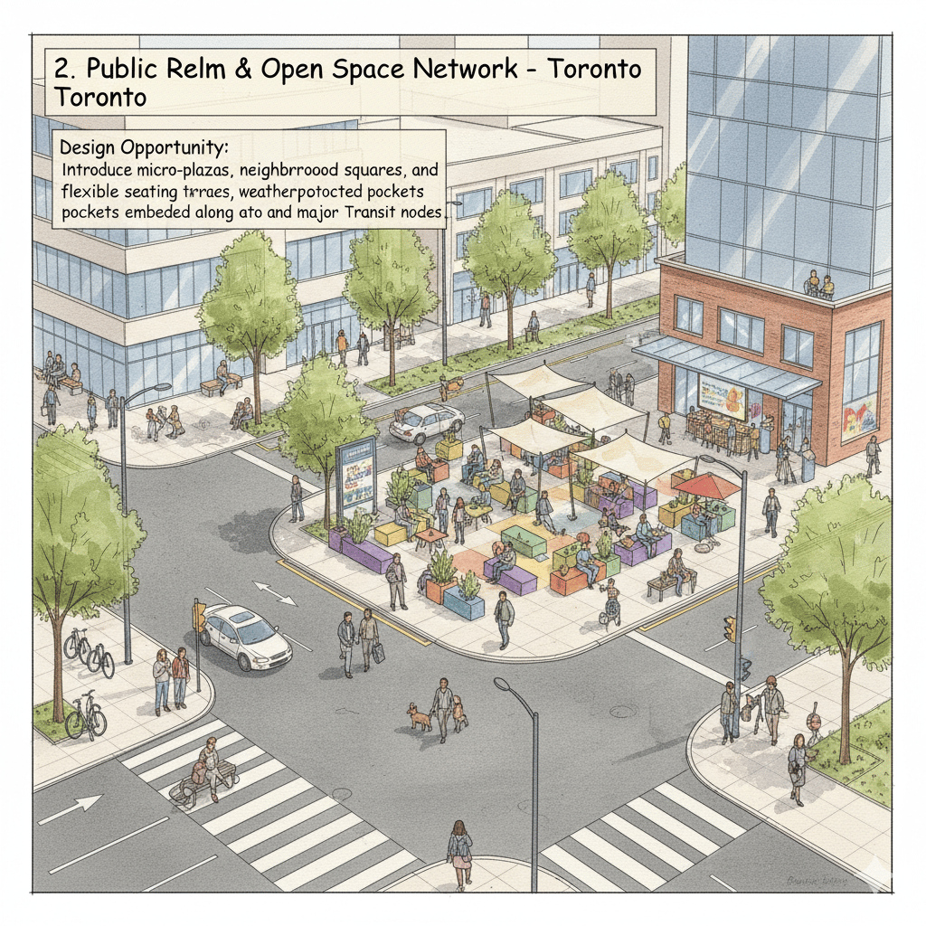
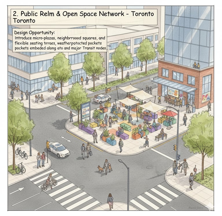
2. Public Realm & Open Space Network
Toronto contains key civic plazas Nathan Phillips Square, Mel Lastman Square, College Park, David Pecaut Square but many neighbourhood-level open spaces lack:
Identity
Program diversity
All-season usability
Human comfort (shade, wind mitigation, seating)
Public spaces must support daily life, not only scheduled events.
Design Opportunity:
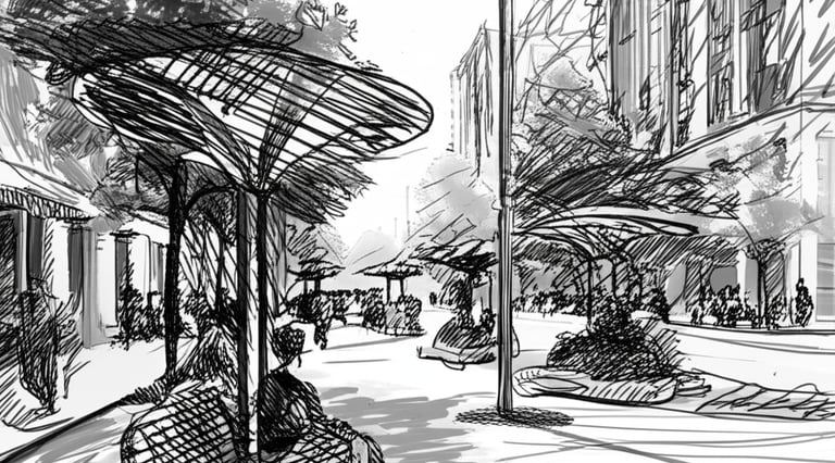
Introduce micro-plazas, neighborhood squares, flexible seating terraces, and weather-protected social pockets embedded along major streets and transit nodes.
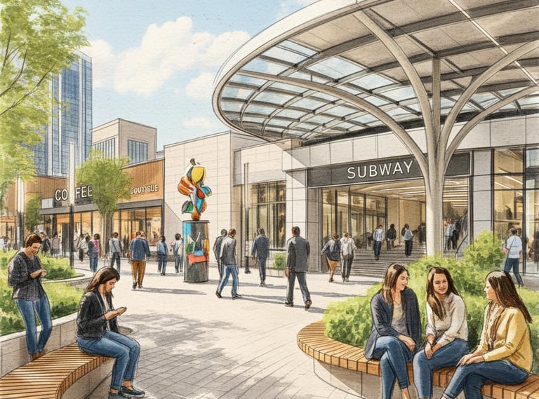
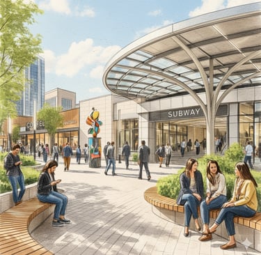
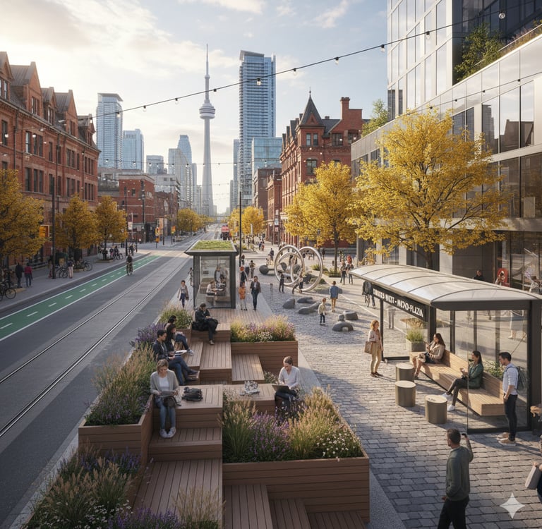
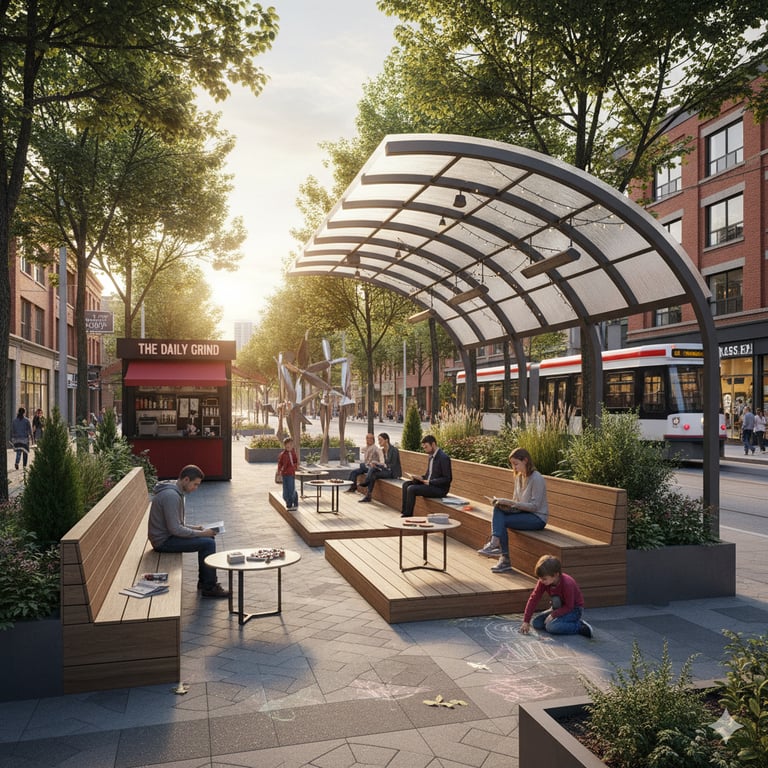
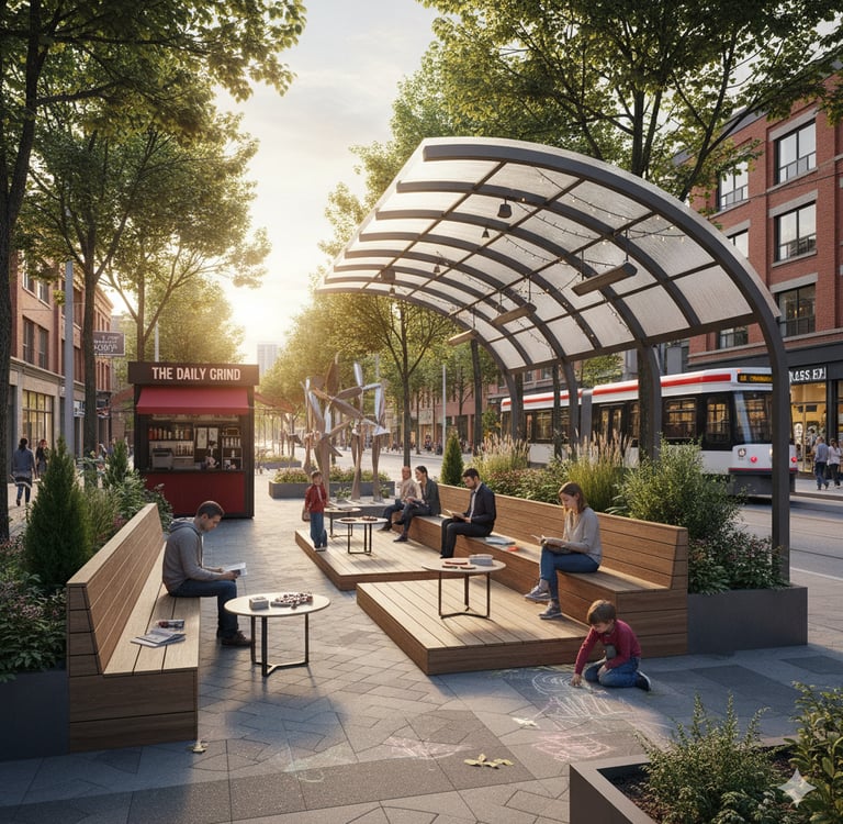
3. Transit & Node Activation
High-density development is concentrated around subway stations (e.g., North York Centre, Eglinton, Yonge–Sheppard, Finch).
Yet many transit edges are:
Hard, windswept, and inactive
Designed only for circulation, not gathering
Lacking street-oriented retail or social infrastructure
Design Opportunity:
Transform transit edges into arrival experiences with:
Canopies and shelters
Shops and kiosks
Public art and interactive lighting
Comfortable waiting + meeting spaces
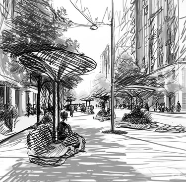
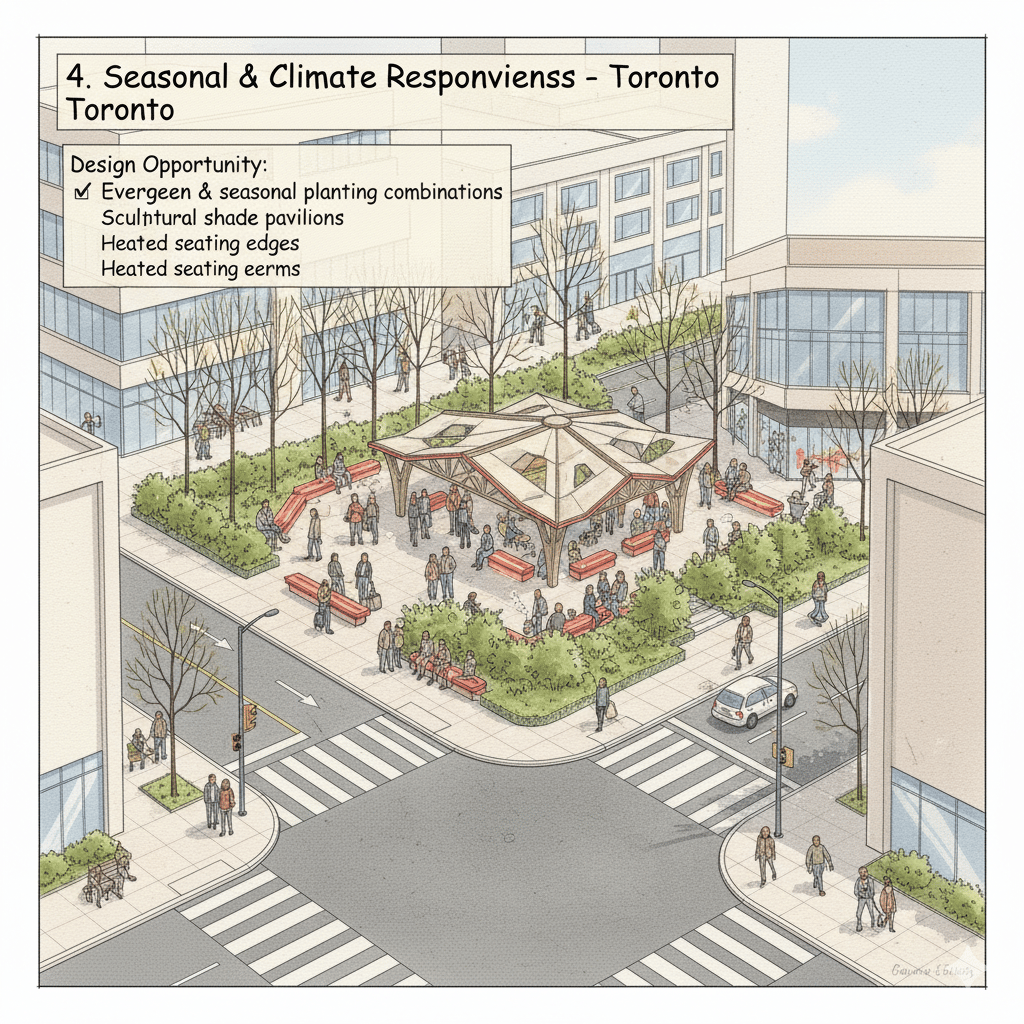
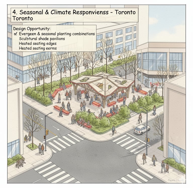
4. Seasonal & Climate Responsiveness
Toronto’s climate cold winters, hot summers demands adaptive public realm design.
Current issues:
Shade scarcity in summer
Wind exposure in winter
Limited year-round landscape presence
Design Opportunity:
Evergreen & seasonal planting combinations
Sculptural shade pavilions
Heated seating edges
Wind-softening landscape berms
to maintain comfort across seasons.
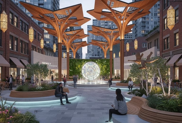
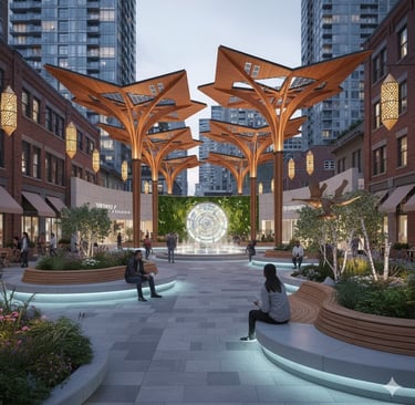
5. Architectural & Cultural Identity
Toronto is architecturally diverse but often lacks place-specific landmarks at everyday scales.
Many plazas and street edges are visually generic and do not communicate local identity or cultural resonance.
Design Opportunity:
Introduce signature urban elements:
Sculptural shading structures
Custom seating forms
Art integrated with landscape + lighting
These do not act as isolated art pieces, but as functional civic infrastructure that invites people to stay.


Begin a Design Inquiry.
Transforming ideas into breathtaking architectural realities.
contact:
Start an Inquiry:
© 2024. Sama Karim Design Studios. All Rights Reserved.